2024/12/05
- Bugfix: Infinity loop of error alert popup when all of followings conditions are met.
1, Using Chrome/Edge/Opera
2, Quick Search option is enabled
3, There is some string on the clipboard, and that is invalid as location value.
4, Return the app focus from other tab or app window, or close some popup such as alert/confirm/prompt.
2024/11/30
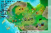
- Added Sanctuary of "Madflats"
- Fixed area name of "West Access"
2024/11/03
Evrima(Gateway) update (v0.17.54)
◻️ East area update
- East plains changed to forest
Trivial changes or older than above is written in Update history
Zoomrotate Mouse-wheel on map
¼'1'''4 Layers
■Landmark Mud pool ■Mountain ■Ocean ■Spawn/TP
■Pond/Falls ■River
■Road ■Trail ■Ditch ■Cave
* AI options show the area
where they often spawn.
* There's some possibility
to pop to other places too. Drawing option
Basemap quality
Emphasize Latest Location
Display amount of location hist.
Keep your location hist.
Latitude value of north is...
* WIP
Histories
● Latest
① Normal: connect by number
➊ Fixed: connect to latest
* click ①/➊ to toggle
When history amount exceeds 20,
oldest will be deleted
GroupID:
This feature requires UserID
Please register here: [My Data]
About this feature ...
- You can share locations with
those that use same GroupID.
* Make sure to use
complex string for GroupID
to prevent sharing data
with non group members.
After joining ...
* When searching your location,
it will be registered as your
current location in group data,
and last searched locations of
every member will be mapped.
* Anyone that hasn't updated
their location in 30 minutes
will automatically get removed.
* Don't forget to click [Leave]
when you stop playing.
* Temporaly closed.
Opacity
Brightness
Contrast
Hue
Saturate
This feature requires UserID
Please register here: [My Data]
[Beta] Rotate
* This is just an idea.
May be abolished.
Rotate
Tilt
* If you don't see anything here, try Super reload (such as Ctrl+F5)
Readme - VulnonaMAP for The Isle
* When I added important note, check of [Don't display this] will be ignored only once
New version (ver4) is published ➔ https://vulnona.com/game/map/
* New version is including both of The Isle and Path of Titans.
You can continue to use this version (ver3), but no longer update/suppot.
If you wanna latest data, please use the ver4.
This map is not an official service, irrelevant to Afterthought LLC.
The map image is a composite of in-game screenshots, and that copyright belongs to Afterthought LLC.
If you meet a bug, please contact to ME.
Please do not bother (ask to) game devs.
Please do not dependent on this map
I never say "You shouldn't use this anymore after you get used to there".
But let's be able to walk arount without this as possible as you can.
If you neglect to learn the topography, someDay youwillbeIntroublE ...
This map is just hobby
I'm just only freely doing "what I want" at "my own pace".
If there are major changes or additions, I can't respond immediately.
This site is provided on my home server.
When occuerd equipment or power failure, this site will be temporarily unusable.
To those who continue to use
If you know what I hadn't write, another name, my mistake, ... , tell me it.
Thanks for your cooperation :D
Left-drag … Normal mode: you can drag untill you release left button.
Right-click … Toggle mode: you can drag untill you click again.
* When mouseout, dragging will be force stoped.
Every map is North-UP
Direction of these map is based on the North Star and Geomagnetism, not based on value of Latitude or the path of the sun/moon.
Please be carful, Legacy and Evrima has different Latitude/Longitude axis.
There's a few displacement due to altitude
Gridline and Location marker are not completely accurate.
When you wanna know your perfect correct position, you should take a closer look at the surrounding topography.
How to display the location
by using ASSET LOCATION string
How to get it?
1, Open Character panel (default is [insert] key, or select from [Esc] menu.
2, Click "ASSET LOCATION" to copy
3, Paset it to "Location" form
All of following formats are supported!
by input directly like as "-123,456"
This will be treat as 1000 times value as often used to tell it on chat.
e.g. "123,456" means "(Lat: 123,000.0 Long: 456,000.0 Alt: ***,***.*)".
Detail of analysing rule:
Inputed string is treat as string that joined following 3 value.
[1] numeric (If this has a minus sign immediately before, include it)
[2] non-numeric (any-length)
[3] numeric (same as [1])
Example of how recognized:
* note: Be careful if Long value is 0 or larger, separating character is require 1 or longer length to processed correctly.
Some names are not mainstream
Besides the name that I checked in game chat,
I refered to map made by others, or I named it from terrain.
Dull color names may be told "Where do they mean?".
Please tell me if you call the place as other name.
AutoIsleMapper
Ritalin44#0001 made this for more quick and eazy to check your current location.
When launched, it displays this map in the built-in chromium browser, and immediately displays the coordinates when the clipboard is updated.
IsleMaps
A great site that released Gateway interactive map first.
This map image is courtesy of this site.
Others
Sound of The Isle (for Legacy branch)
There are sounds of roar/sniff/footsteps. Quiz is also attached as bonus.
咆哮、匂いを嗅ぐ時の音、足音を収録しています。オマケでクイズもついています。 おいでよ きょうりゅうの島 (Discord)
恐竜ゲーム同好会(日本語プレイヤーズコミュニティ)。
地図の使い方やTIについてのいろいろ、その他の恐竜ゲームについての情報等も掲載してます。
This is Japanese Language Community.
The color of circle displayed around the safe-rock is a measure of safety.
Green
Safety assured. It's the best place for a nap.
Part of the rock is very very safe.
While you are there, threats can't any other than walk around and make noise.
* Pachy/Galli/Dryo can ride on some rocks. (e.g. raptor rock)
* All of on V3 had confirmed whether Utah can escape attack of full-adult Giga.
Thenyaw haven't yet.
light Green
Almost Safety. I think it is also good.
Everyone can enter, but no-jump species will be afraid and hesitation.
If they do, break leg, can't go back, no choice but to fall off the cliff.
Yellow
A bit small. Don't forget to watch out.
Should be afraid of Large-sized dino's wide attack range.
They might be able to kill you from outside.
Red
Dangerous. Only stupid use it.
1) Too small. You will be attacked from not only Large-sized but also Medius-sized.
2) Meaningless for who knows how to climb. Bigger can climb without jump.
It's no doubt that there is safe compared to other places.
But, big dinos have a longer reach than you, and they can go up steps that you can't.
If you don't wanna die, you should rest at high places as far away as possible from the edge.
When the threat surrounds, you will be forced to spend a hard time as if you're in cage of non-fed zoo.
If you think "I have to death if this situation continues!", you should try to escape at the risk of your life, or safe-log.
* In order to endure for a long time, I recommend to eat/drink, before use, and while you think safe.
Don't forget this.
1) You also have a choice of "hiding in tree". (It may be safer than on rock in some cases)
2) No matter how high you climb, non-friendly Utahs can kill you.
I Love Utah! Yeah!! ヽ(*´∀`)ノ
You can open this again at any time from the link "Readme" at top of sidebar


 Isla Spiro #4-2
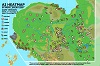 Isla Spiro #4
 Isla Spiro #3
 Isla V3
● Latest
① Normal: connect by number
➊ Fixed: connect to latest
* click ①/➊ to toggle
When history amount exceeds 20,
oldest will be deleted